
Services
Research and assessments
We systematically record spatial data in the field and utilize state-of-the-art analytical methods to improve understanding of the social, environmental, and managerial factors that influence the sustainability of trail and campsite infrastructure.

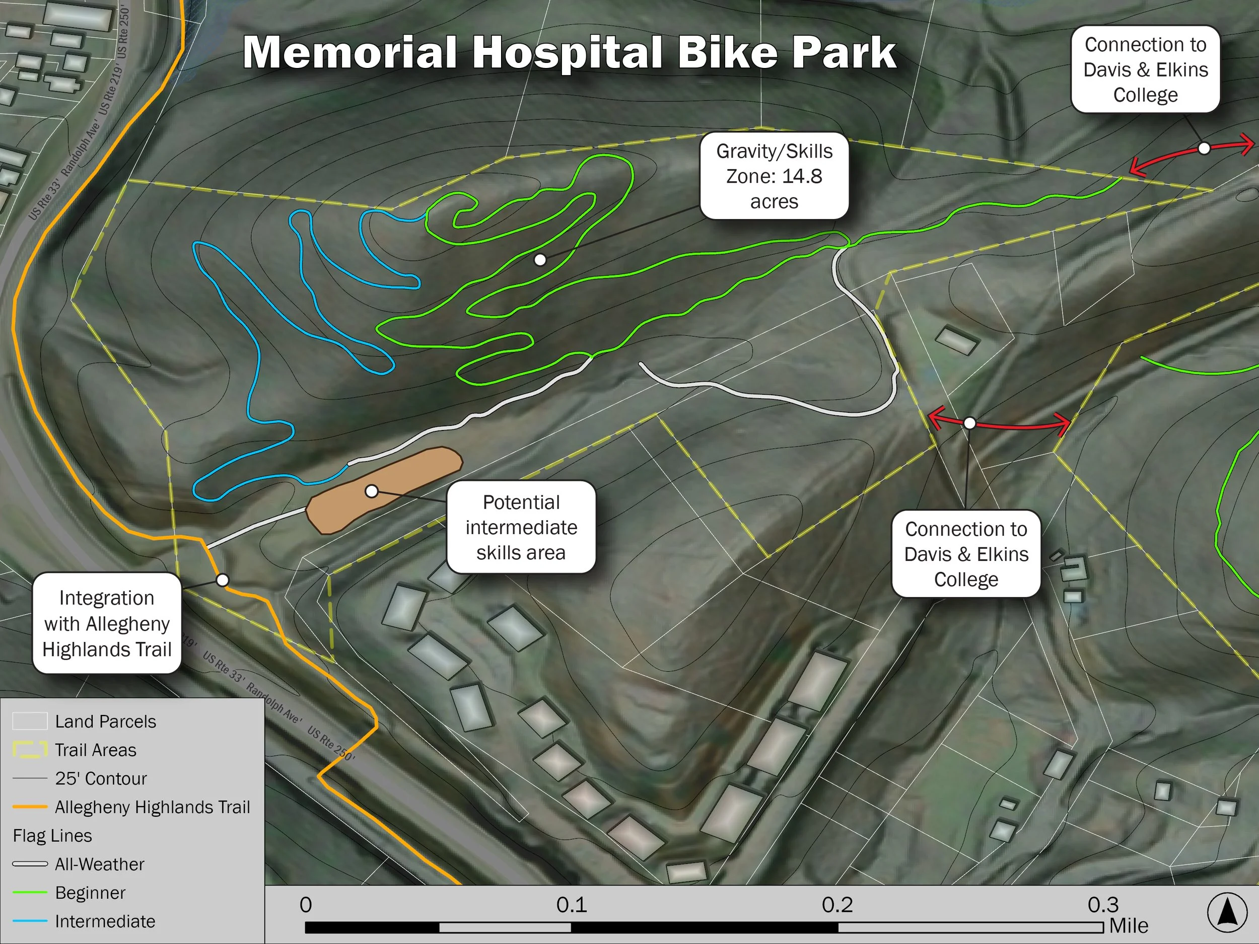
Mapping and GIS
We use GIS and graphic design software to create high-quality custom cartographic products that clearly display and communicate spatial data to support trail research, assessments, design, and construction.
Planning and design
We use GIS tools and field visits to scout and assess terrain for potential trails. We use this data to identify and lay out sustainable, low-impact trail corridors that support the intended types and amounts of recreation while remaining in good condition with minimal maintenance.